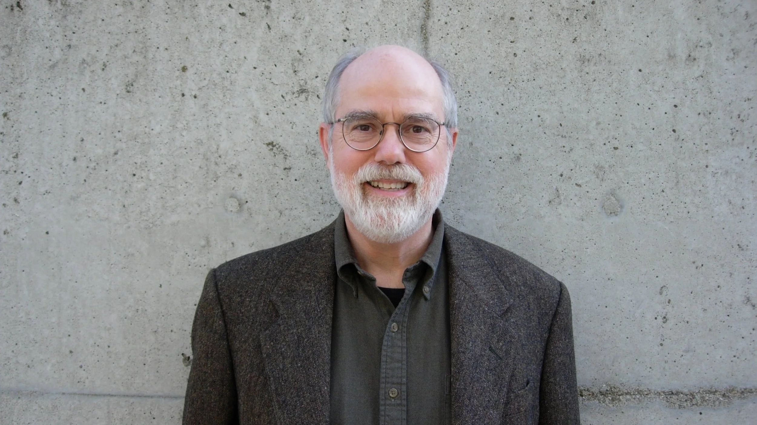
A Conversation with Paul Groth
In 2015, Paul Groth, professor emeritus of geography and architecture at the University of California, Berkeley spoke with PLATFORM Contributing Editor Sarah Lopez about his career, research methods, and field. A full transcript of their conversation was published in Room One Thousand, a Berkeley student journal. What follows is an abbreviated version, edited for length and clarity. For the original audio recording of this conversation, navigate to the end of this article. For more on Groth’s work, see “Paul Groth: A Festschrift.”
Sarah Lopez (SL): I want to start by asking you to describe how you learned of cultural landscape, and what it was (and is) about it that resonated with you so forcefully?
Paul Groth (PG): I graduated in 1972 with a five-year professional bachelor of architecture degree. A lot of designers were thinking about contextual design and trying to fit their designs into the surroundings rather than creating a standalone building. I wanted to know how to do that, and no one really had an answer. For me, this was all happening in Fargo, North Dakota. I got my degree from North Dakota State University.

Figure 1. The force of nature. Photograph by Paul Groth, n.d.
Directly after graduation, a friend and I got a grant to teach schoolteachers about the built environment. There were thirty environmental fellows across the country offering similar courses with a large grant from the National Endowment for the Humanities.
My friend and I circuit-rode eastern North Dakota, offering evening classes. It wasn't that our students were not connected to high-style architecture. They weren't connected to the built environment at all, and we couldn't find materials on how to teach the ordinary environment. So, the need to learn how to do contextual design, and then trying to teach people about the ordinary environment, hit me about the same time. And at the end of our year, the person who had written and supervised the grant said, "I see you need to know about small towns and farms, and there's one person who knows how to do that. His name is John Brinckerhoff Jackson, and he publishes a journal called Landscape. So I think you should be in contact." And that's where it all started.

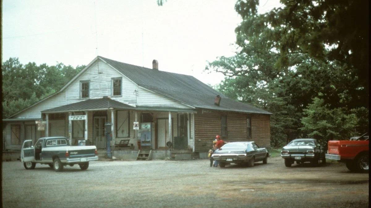
Figure 2. Urban cyclical investment of capital. Photograph by Paul Groth, n.d.
A couple of years later, I was writing a statement of purpose to go to graduate school. At that point I thought I was going to be in American Studies, and I sent a draft to Jackson, and asked if I could meet him. I was going to take a bus across country from New York, where I was then working, to Los Angeles and Berkeley. I stopped by Santa Fe [where Jackson lived] on the way. He started off saying, "Well, in our field, what you want to study is not American Studies, but geography." He had read my short statement, and he listed the four geography departments I should consider and the people I should talk to in each place, because they had all written for his journal. I had never taken a geography course so this was news to me.
One of the geographers I was supposed to meet — Donald Meinig from Syracuse—was at Berkeley, applying for a teaching job. I got to meet him, hear him give two lectures, and conversations between the Berkeley faculty and Meinig. I realized these people at Berkeley were doing exactly what I needed to know. I applied [and] came to Berkeley in 1976.

Figure 3. Rural cyclical investment of capital. Photograph by Paul Groth, n.d.
SL: Shortly after, you took over Jackson's cultural landscape course. How did you transform it?
PG: Jackson had taught a bit about Colonial New England and the lowland South. But he didn't talk about the mid-Atlantic, Midwest, or upland South or the West. Jackson was particularly interested in small towns and farms and houses but he didn't have many lectures about the city, factories, and industrial sites (what I came to study). I [also] added general processes of cultural landscape change — guidelines about how to see the landscape. Jackson alluded to some of these, but he certainly didn't talk about economics and class struggle. I didn't need to take any of his material out, I just added things onto it. Jackson contributed how to look widely at the whole built environment, that everything is information. That every kind of building, every kind of setting is information about American culture and society, and that we have things to learn from it.
SL: I know you're an avid road-tripper, and that when you were building the course you took trips of 3,000 to 5,000 miles every few years. How did you plan?
PG: I learned how to do road trips from experts. I took every field trip that was offered in Geography. I took a two-week trip with Pierce [F.] Lewis out of Penn State. When I would go to geography conferences, or later the conferences of the Vernacular Architecture Forum, they had great field trips.

Figure 4. The Land Ordinance of 1785. Photograph by Paul Groth, n.d.
The prompt for a trip is that I usually have someplace to go. A conference, a family event. Then I look at a map, see the freeway route, [and] find a parallel route, maybe forty or fifty miles away from the freeway. On these routes, sometimes called “blue highways,” it's easier to stop. You see more of the local environment, especially the small towns and the county seats along the way.
These days, I know where I'm going to be each night — but in the old days when I was out exploring, at about 3:00 in the afternoon I would project where I was going to be at suppertime [and] call ahead and get a motel.
I took two kinds of guidebooks. I took the Federal Writers Guides written during the 1930s in the New Deal. There's a volume for every state. They talked about every little town along the route, as well as the route itself, and background on the state. I also take the salient AAA guidebooks along, [which] start as a summary of the New Deal guidebooks, to help find motels and to see when museums were open and things of that sort.
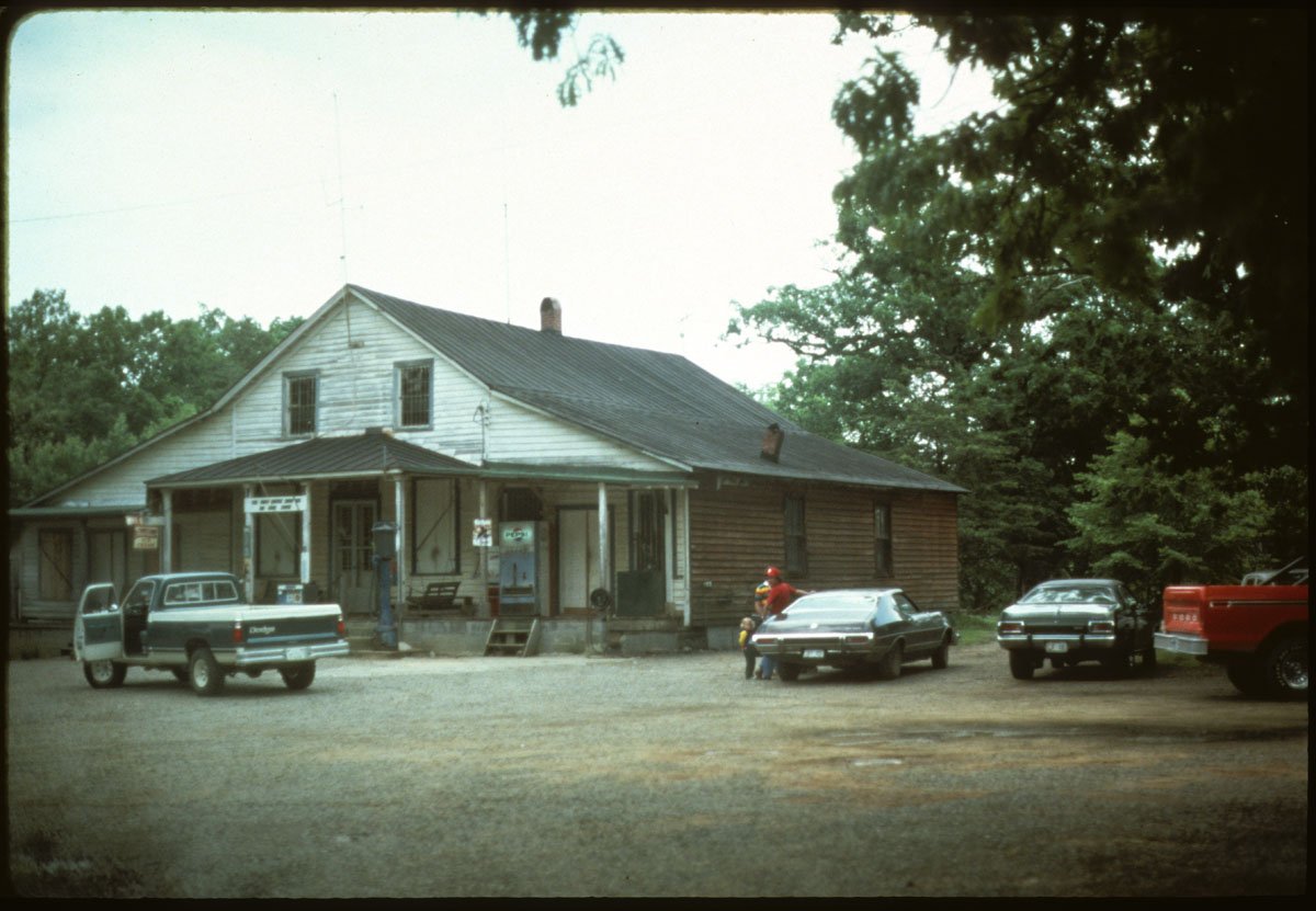
Figure 5. Reinforcing individual and social identities. Photograph by Paul Groth, n.d.
For example, I was in the sand hills of Nebraska, which is pretty sparsely settled terrain. The AAA guidebook said there was this great museum of the Indian trade in Chadron, a town of about 2,000 people. It was a long one-story building. It didn't look promising at all. But inside was, in fact, a terrific collection from the colonial era of America to about 1930 of all the trade goods between Native Americans and Anglo-Americans. It was an amazing museum, and I would never have stopped there if it hadn't been a star rated stop in the AAA guide book.
Because I'm often driving alone, I make sure to get out of the car at least once an hour to take a picture of something, if nothing else just the road I'm traveling on. So I'll remember where I've been, and stay awake.
SL: The guidebooks you used from the 1930s capture one moment in time, the AAA guidebook captures another, and then your eyes and your experience on the road captured a third, so I can see how you were able to come up with patterns, arguments, and conclusions about what you were seeing.
PG: Often those conclusions come when you get home, when you're looking through slides and what notes you may take on site. Remember now, I had taken Jackson's classes, and I had also taken a lot of geography classes, so I had been trained how to see. Jackson had always said he didn't have his major 'A-ha's' out when he went to explore, he had them when he got back to his desk and started to write.

Figure 6. Local versus distant investment of capital. Photograph by Paul Groth, n.d.
SL: How has the cultural landscape has changed since you started taking these road trips? Is there anything going on either in cities or in the countryside now that you find to be critically important? What are you paying most attention to right now in the built environment?
PG: Now I'm looking at the effect of corporate investments and how larger corporations are buying up more of the environment. International investment is much greater now than when I started out. I remember driving up the Mississippi River Valley about a hundred miles north of New Orleans. There was this giant grain elevator which didn't surprise me because it was farm country. But it was all owned in Japan. And in Japanese characters, the name of the corporation was painted on the grain elevator. That's the kind of thing that seems new.
There were certainly lots of ethnic migrants or immigrants that left their traces on the landscape, and I think I'm better at seeing the imprint of migrations, both past and present, now than I was twenty or thirty years ago. And, of course, ethnicity, immigration, and migration have been very important themes in the last ten to fifteen years.
SL: Earlier you mentioned that the clouds parted when you realized that major societal questions could be researched in the material world. What methods did you use to research your book Living Downtown: The History of Residential Hotels in the United States?

Figure 7. “Residential Hotel Rooms by Type San Francisco 1930,” pie chart by Paul Groth, n.d.
PG: My dissertation, which went on to be the book, was about the history of people living in hotels — from hobo flop houses all the way up to palace hotels. To do that work, I started with a case study of San Francisco between 1880 and 1930. I hammered out a method to figure out what was ordinary in urban buildings because there are thousands of possible examples.
To do this, I relied on what was called cliometrics. That term ties the name of the goddess of history to quantitative methods. I've never written this down, it's not part of the book. But I used city directories and looked into the headings of hotel, boarding house, lodging house, all the kinds of headings that hotels might have been under, especially the cheap ones. Then I would clean out the duplications from the lists. For 1880, 1910, and 1930 I had a list of about maybe 2,400 buildings by address. Then, using a random number table — this is the quantitative part — I chose a sample, a quantitative social scientific sample, of one-eighth of those hotels. So instead of having to research thousands of buildings and figure out what was ordinary, I only had to research about 300 buildings. I still didn't know what was ordinary, but I knew I had this random sample. Then I looked at each on Sanborn Maps, which are fire insurance maps that show the outline of every building. Other city records survived for 1910, 1930. All the 1880 records had been burned in the Great Fire of 1906, but the city water company records had survived. Their vault survived the fire. I used the records from the city water company for all 300 buildings.

Figure 8. Basic rooming house for low-paid skilled workers like stenographers and clerks above a loan shop, San Francisco, Calif. Photograph by Paul Groth, n.d.

Figure 9. Basic rooming house for low-paid skilled workers like stenographers and clerks above a loan shop, San Francisco, Calif. Plan by Paul Groth, n.d.
When I finally got those 300 addresses, I made a four-by-six card for each building. Then I sort[ed] them into piles based on the square footage of each room (which I had computed) and where they were located, because that would suggest whom the buildings were intended for. I'd also gone to look at each building from the outside and had written notes about them. Eventually, the piles of cards began to be in four clumps.
The key definer, what clump they were in, wasn’t so much what they looked like, the number of rooms, and not even necessarily their location, because there was a lot of social mixture in San Francisco, especially before 1910. It was the plumbing. Palace hotels had one bathroom for every room. In the mid-priced hotels, about half the rooms had one bathroom, half the rooms had a bathroom down the hall. In the rooming houses, which were the third rank of hotels, almost always the bathroom was down the hall; at a ratio of about one bath for every six rooms. And for the cheap lodging houses, which were the hotels for hobos and migrant workers or formerly migrant workers, the ratio was often one to twelve, the minimum in the city code, or even less. The plumbing wasn't necessarily visible, but there were records of it in the water company files, that's because they used to charge by the fixture before they invented the water meter. The plumbing turned out to be a really key source. That's my secret method of knowing how to discern what's an ordinary building type.
SL: With the water records you really hit a goldmine.
PG: I had hit a wall because of the Great Fire, and then someone told me that the water company records survived. It was not part of my prospectus. I didn't know anyone else who used water company records. But it was part of the process of doing the work.
I was also very lucky because the two weeks I went in to use the records, the [manager was gone and, the] staff let me behind the desk to use most of their Sanborn Maps, which had also survived the fire, and what were called tap records in their vault. It would've taken me a very long time going up, one at a time, and asking for the tap record of every building.
Another great source turned out to be something that the Dean of the College of Environmental Design at that time, Roger Montgomery, told me about: the Real Property Survey, a New Deal project, aimed at documenting downtown buildings. And the Real Property Survey data cards — there was a card for every building — were at the Bancroft Library. Once again, the manager was gone when I went in and the other staff were bringing me whole boxes of data. Then the curator came back, again after about two or three weeks. That saved me at least two or three months in the archives.

Figure 10. The Hotel National, cheap lodging house for hobos and casual laborers above an Army/Navy store, San Francisco, Calif. Photograph by Paul Groth, n.d.

Figure 11. The Hotel National, cheap lodging house for hobos and casual laborers above an Army/Navy store, San Francisco, Calif. Plan by Paul Groth, n.d.
SL: How have cultural landscape methods have changed over your career?
PG: There's more urban cultural landscape work being done now than in the early 1980s when I joined the VAF. The members of the VAF at first were mostly looking at rural buildings, small-town buildings like cultural geographers were doing back in the '60s and '70s. There's [also] beginning to be more international work. It used to be strictly the U.S. and Canada. Some of the questions are changing, especially when you get into urban vernacular buildings. The questions of social class and ethnicity can be more important than they are in rural areas. Part of [this evolution is] that is that now with the VAF[’s] Buildings & Landscapes, there's a really good journal attracting better scholarship. Just as J. B. Jackson's journal called Landscape was important in gathering people together and getting them to see what each other were doing, Buildings & Landscapes is bringing people together and helping people share their methods.
SL: How does cultural landscape studies relate to design?
PG: I think of cultural landscape as anatomy for designers. In design studios, we're trained to be like heart surgeons, to work on special parts of the body, and we don't learn about the rib cage or the muscles or things surrounding the heart or the lungs. A cultural landscape study, knowing the whole built environment, or being curious about the whole built environment is essentially anatomy for designers. If you're not thinking of doing contextual design, which is now out of fashion, you still need to know the context that you're designing within. That's an important part of architectural expertise.
CITATION
Paul Groth and Sarah Lopez, “A Conversation with Paul Groth,” PLATFORM, January 10, 2022