Reimagining New Delhi’s Central Vista, Part I
This is the first article in a series of two.
In late 2019, India announced plans to comprehensively redesign and rebuild large parts of the government core of New Delhi, in recognition of the country’s seventy-fifth anniversary of independence. The “central vista project,” as it is known, aims to “restore” the “symmetry and order” of Edwin Lutyens’ original 1912 design for the city center, while adding up-to-date administrative infrastructure, including a larger Parliament house and, along the vista’s central axis, a series of massive interlinked government bhavans (“houses”).
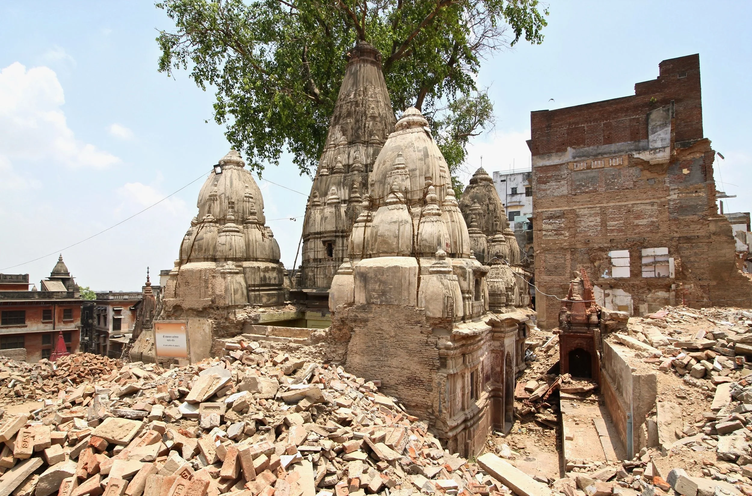
The project is the signature undertaking of the Narendra Modi administration’s atmanirbhar bharat program for a “self-reliant” India. Designed by Bimal Patel (the same architect behind the Vishwanath Corridor project in Varanasi), the vista redesign is the most ambitious of a series of “urban modernization” schemes that have marked Modi’s time in power. The result will be a substantial centralization of the physical administration of government into the core of New Delhi and an unprecedented re-emphasis, in its physical form, of the city’s original imperial ethos.

Figure 1. New Delhi’s central vista, redesigned by architect Bimal Patel. Courtesy of HCP.
For over a century, New Delhi’s central vista has acted as a kind of microcosm for discussions about national politics as well as the character of greater Delhi’s urbanism. The vista has been the scene of imperial pomp, national celebration, cultural displays, and popular protest. Recently, it has become a touchstone for debates about the character of India’s national government, and critics have linked the lack of public consultation on the new central vista project with the authoritarian tendencies of the Bharatiya Janata Party (BJP). The unveiling of snarling lions atop the new Parliament earlier this year, as a reimagining of India’s “national emblem,” hasn’t helped matters in these regards. Others have worried that the project, along with attendant zoning changes, will result in the loss of one of New Delhi’s principal public green spaces to a strengthened government security regime.
I am skeptical of the aims of the central vista project and the processes that underlie its planning, and fearful of what the final product may amount to. But I’m also wary of the arguments being put forth by many for preserving the vista as it was. No one should worship the ashes of Britain’s empire. Instead, Indians should imagine how the old imperial axis can best be integrated into a vibrant, modern, democratic city space.
This is something that an examination of Delhi’s recent history can help us with; a history in which questions of sovereignty, governance, and city space were closely intertwined and the subject of much experimentation and debate. In this article, which is the first of a series of two, I introduce the history of New Delhi’s original design and explore its evolution in the early years of India’s independence after 1947. In part two, I turn to examine efforts during the 1950s and ‘60s to comprehensively re-plan Delhi, and along with it, the central vista, and ask what lessons we might learn from that exercise. The central vista has from its inception been an integral part of the city of Delhi, but it has never been a static one.
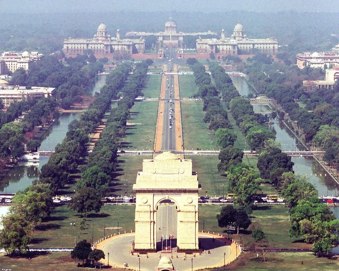
New Delhi’s central vista is a two-mile long processional route: a stretch of road, lawn, trees, and decorative ponds, oriented roughly west to east. It connects India Gate (a World War I memorial) on the eastern side, to the Secretariats (the principal administrative buildings of the government of India), Viceregal Palace (now Rashtrapati Bhavan, home to India’s President), and Parliament to the west.
The design was concocted principally by the English pastoralist Edwin Lutyens, who was one of two architects appointed by the British government of India in 1912 to the task of creating a new capital, to replace Calcutta, for the Indian empire. (The other architect was Herbert Baker, then fresh from his successes in designing Pretoria’s Union Buildings in South Africa). New Delhi’s layout is unmistakably City Beautiful– and Beaux Arts-inspired, with its formal origins in Pierre L’Enfant’s overscaled baroque plan for Washington, D.C.
Figure 2. New Delhi central vista, basic outline, ca. 1931. Drawn by Michael S. Dodson.
New Delhi is also unmistakably imperial in its structure. This is unsurprising, given that the city was conceived, in part, in reaction to nationalist agitation in Calcutta. New Delhi, from the start, was a re-setting of empire in physical form at a site long associated with political power over the subcontinent. Housing, for example, was strictly hierarchical, allocated according to rank and race. And the Viceroy’s Palace was sited atop Raisina Hill to mimic the Capitolium of imperial Rome. Indeed, ancient Rome was the persistent touchstone for New Delhi’s design. As Baker once approvingly noted, “Only Rome in her greatest days did what England has been doing” in India.[1]
Another key feature of New Delhi’s imperial character is its street layout, which consciously linked the western end of the vista to the Mughal-era Jama Masjid, to the northeast, and the Purana Qila—the reputed site of Indraprastha and the mythical home of the Pandavas (sovereigns in the ancient epic Mahabharata)—to the east.
In this way, New Delhi’s roadways imbricated the city into a landscape of highly significant architectural ruins; a virtual matrix of the vestiges of the subcontinent’s earlier ruling dynasties. And yet the British also cut New Delhi off from these older centers of habitation. There were few roads linking the new capital with the walled Mughal city of Shahjahanabad, and the designers wished to demolish the bustling marketplace of Paharganj between the old city and the new. The city was designed, in essence, to sit at the center of all of greater Delhi’s historical cities but remain aloof from them—transcendent, even— with the new vista acting as the core of that symbolic geography. New Delhi was an imperial form written upon the north Indian landscape by its political overlords—an ideogram of empire.
Figure 3. New Delhi spatial orientation, viz. older sites of political sovereignty. Drawn by Michael S. Dodson.
In his famous 1931 essay, Robert Byron described New Delhi as an appropriate physical setting for the “magnificence” of British power overseas but also, importantly, as a “monument” and a work of art. Byron’s prose rendered Lutyens most evocatively as New Delhi’s chief artist, rather than its chief architect. The city was, in this reading, a sublimation of political power within the high achievements of art—or perhaps its artistic virtue was a kind of proof of the British right-to-rule. “Beauty is infallible,” Byron wrote, “and confers a measure of right on its creators, whatever their sins.” New Delhi represented Britain’s continuing commitment to perceiving, and presenting, itself as a world-maker.
Figure 4. “North block” of the Secretariat buildings, New Delhi, designed by Herbert Baker, completed in 1927. Photograph by Alexandra Lande, courtesy of Adobe Stock.
In 1947, when India gained its independence, the country’s new leaders were less enamored of their inherited capital than the British might have imagined. The physical structure didn’t easily invite social vitality or change; it was too spread out and hierarchical for that. Jawaharlal Nehru, India’s first Prime Minister, also disliked New Delhi’s architectural style, even while he understood the utility of the space those buildings afforded his new government.
The problem of how to transform New Delhi into a city more appropriate to a young democracy and which better served India’s social and cultural development was, however, forced into the background as Nehru’s government focused on more pressing concerns. In the first decade of independence, Delhi’s population doubled to about two million, as refugees streamed into the city from across the new borders with Pakistan; it was predicted that it would more than double again, to five million, by 1981. Much of the government’s effort in Delhi, understandably, went towards parceling out land for new housing, the creation of “rehabilitation” colonies for the displaced, and slum clearance.
It was not until 1957 that India’s Town Planning Organization and the Delhi Development Authority, aided by an international team of consultants hired by the Ford Foundation, began work on a new master plan for the city. This was the first concerted attempt to impose some sort of order on the post-independence capital while also working out how best to channel its future growth.
“Indians should imagine how the old imperial axis can best be integrated into a vibrant, modern, democratic city space.”
At the core of this master plan for redevelopment and expansion were several key strategies: that industry should be removed to the city’s outskirts allowing inner parts to be rezoned for single-use (with residential, commercial, and government zones); that population densities should be reduced in overcrowded areas and heightened in others; and, crucially, that the city should be developed with multiple centers, especially in rapidly urbanizing areas to the south, west, and east. This last aim was perhaps a natural one, given that metropolitan Delhi was already a composite of multiple British-era and Mughal-era settlements.
One way to strengthen Delhi’s polycentric character, and a focus of the plan, was to invest in the emerging satellite cities of Faridabad and Gurgaon. Another was to create a series of fifteen “civic centers” at strategic locations within the city proper. These centers would include shopping, entertainment and cultural facilities, and, most importantly, office space. The new master plan recognized the continuing importance of the central vista. But rather than continuing to concentrate government office workers there, it aimed to make it just one of many centers.
Despite this recommendation, new central-government office blocks were already being constructed along the axis to supplement the two original secretariats. The first of these buildings, Krishi Bhavan and Udyog Bhavan, finished around 1957, were adjacent to the secretariats, along the western end of the vista. Constructed by the Central Public Works Department, each rose six stories and sported modernist aesthetic flourishes, including boxed windows and strong vertical lines. Importantly, they were also intended to fit in with the styling of Lutyens’ buildings, with overhanging chajjas (pronounced eaves) and large Buddhist-like domes. Two additional buildings, Vayu Bhavan and Rail Bhavan, were also completed along the vista in the early 1960s.
Figure 5. Krishi Bhavan, New Delhi, Built by the CPWD in 1957. Photography by Leonid Andronov, courtesy of Adobe Stock.
Figure 6. Early Post-Colonial Additions to New Delhi’s Vista. Drawn by Michael S. Dodson.
These additions served to accentuate the importance of the imperial axis, in many respects. But this reinscription of the vista’s symbolic power over Delhi did not go uncontested. In the next article in this series, I examine the ideas of British “townscape” architect Gordon Cullen who, while working for the Ford Foundation on the master plan for Delhi, suggested a radically different direction for the city center which he believed better squared with the democratic structure of the new independent state. Cullen, more than anyone else, saw fresh potential in the central vista that few, including India’s prime minister, could imagine.
Notes
[1] H. Baker, “The New Delhi,” Journal of the Royal Society of Arts 74, no. 3841 (July 2, 1926), 778.